This zone’s water courses are sort of Andean and coastal. The northern sector is dominated by three rivers flowing into the sea, in other words are exorreic.
– The Petorca River: it has a length of 120 km and a 1.960 km2 hydrographic basin, with an estimated 2 m3/s water flow. Is born in the Chincolco locale and, after drifting 72 km, flows into the sea, southwards the Pichicuy small fishing resort (at 54 km northwestwards La Ligua city).
–The Ligua River: it has a lengthwise development of 110 km, a hydrographic basin of 2.100 km2 and an average water flow of 3, 4 m 3/s. It is formed near the Cabildo village, from the junction of the Alicahue river and Los Angeles creek. Its water flow drifts for 44 km until flowing in the same Petorca river zone.
– The Aconcagua River: with a hydrographic basin of 7.640 km2, is born in the Andean zone of the junction of the Juncal and Colorado rivers. The latter flows its water into the ocean northwards, near the Resguardo.
Besides the ranges area, it receives, by the north, the Putaendo river waters and the contribution of several creeks such as the Riecillo, Vilcuya, Pocuro, Quilpue, Catemu, Los Loros, El Cobre, San Isidro and Limache.
It drifts for 142 km until flowing into the sea, northwards the city of Concón.
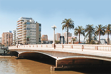
In the southern area, after the disappearance of the transversal valleys, abound creeks originated in the Coastal ranges, among which outstands the Marga Marga, which trail crosses the Viña del mar city; the Casablanca that flows into the sea near Tunquen; the San Jerónimo, that reaches Algarrobo and the yali, which course ends in a grassy lagoon at 15km southwards Santo Domingo.


